Free 50 States Outline Maps Printable Worksheets with Capitals & Nicknames
Download free printable 50 states outline maps. Worksheets featuring state outlines, capitals, and nicknames. Perfect for U.S. geography lessons, homeschool, and classroom activities.
Explore the United States with this free 50 States Printable Pack!
This collection includes a printable page for every U.S. state—featuring:
A simple state outline map
The capital city of each state
The official state nickname
2 Letter Abbreviations
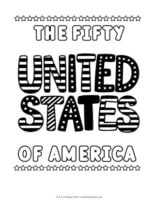
The PDF is 51 pages: a “The Fifty United States of America” cover page, then one page for each state in alphabetical order from Alabama to Wyoming. Each page has the state name and abbreviation across the top, with the capital and nickname in smaller print beside it. Below that, a large blank outline of the state fills the page, with no cities or other labels, so there’s plenty of room for students to add their own.
These worksheets are perfect for:
U.S. geography lessons
State report projects
Coloring pages
Bulletin board displays
Homeschool and classroom learning
Each worksheet encourages students to label, color, and explore each state’s location, name, and identity. From Alabama: The Heart of Dixie to Wyoming: The Equality State, this set is ideal for elementary school classrooms and homeschool families.
💡 Tip: Pair these with lessons on U.S. regions, capitals, and famous landmarks!


 Download PDF – Free Account Required